
-

-
We are specialists for your holidays in La Palma. With personalized assistance on-site.
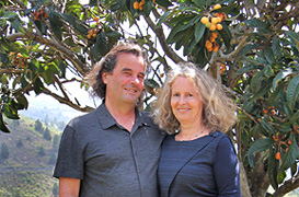
Ulrich & Evelyn Roth -
Our service numbers
Write e-mail+34 822 68 00 89
+49 7442 819 85 90
We're available from Monday to Friday from 10:00 a.m. to 6:00 p.m., and Saturdays from 10:00 a.m. to 1:00 p.m.
-
Accommodations
- with pool 83
- on the seaside 38
- with internet 194
-
Northwest >>
131
- Aguatavar 7
- Arecida 6
- El Castillo 1
- Garafía 4
- Las Tricias 7
- Puntagorda 43
- Tijarafe 22
- Tijarafe Costa 6
- Tijarafe El Jesús 12
- Tijarafe La Punta 21
- Tinizara 2
-
Aridane Valley >>
229
- Celta 8
- Charco Verde 3
- El Paso 23
- El Remo 1
- Hermosilla 1
- La Bombilla 2
- La Laguna 11
- Las Manchas 24
- Las Norias 11
- Los Llanos de Aridane 26
- Puerto de Naos 46
- San Nicolas 8
- Tacande 2
- Tajuya 9
- Tazacorte Costa 5
- Tazacorte Puerto 14
- Tazacorte Villa 23
- Todoque 12
-
South >>
35
- Fuencaliente 7
- Las Indias 4
- Lomo Oscuro 1
- Los Quemados 6
- Salemera 2
- Tigalate 2
- Villa de Mazo 13
- East >> 19
-
Northeast >>
5
- Barlovento 2
- Los Sauces 2
- Puntallana 1
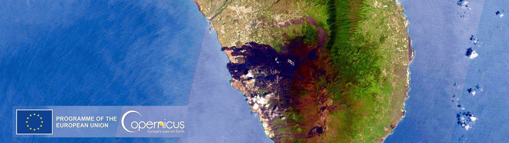
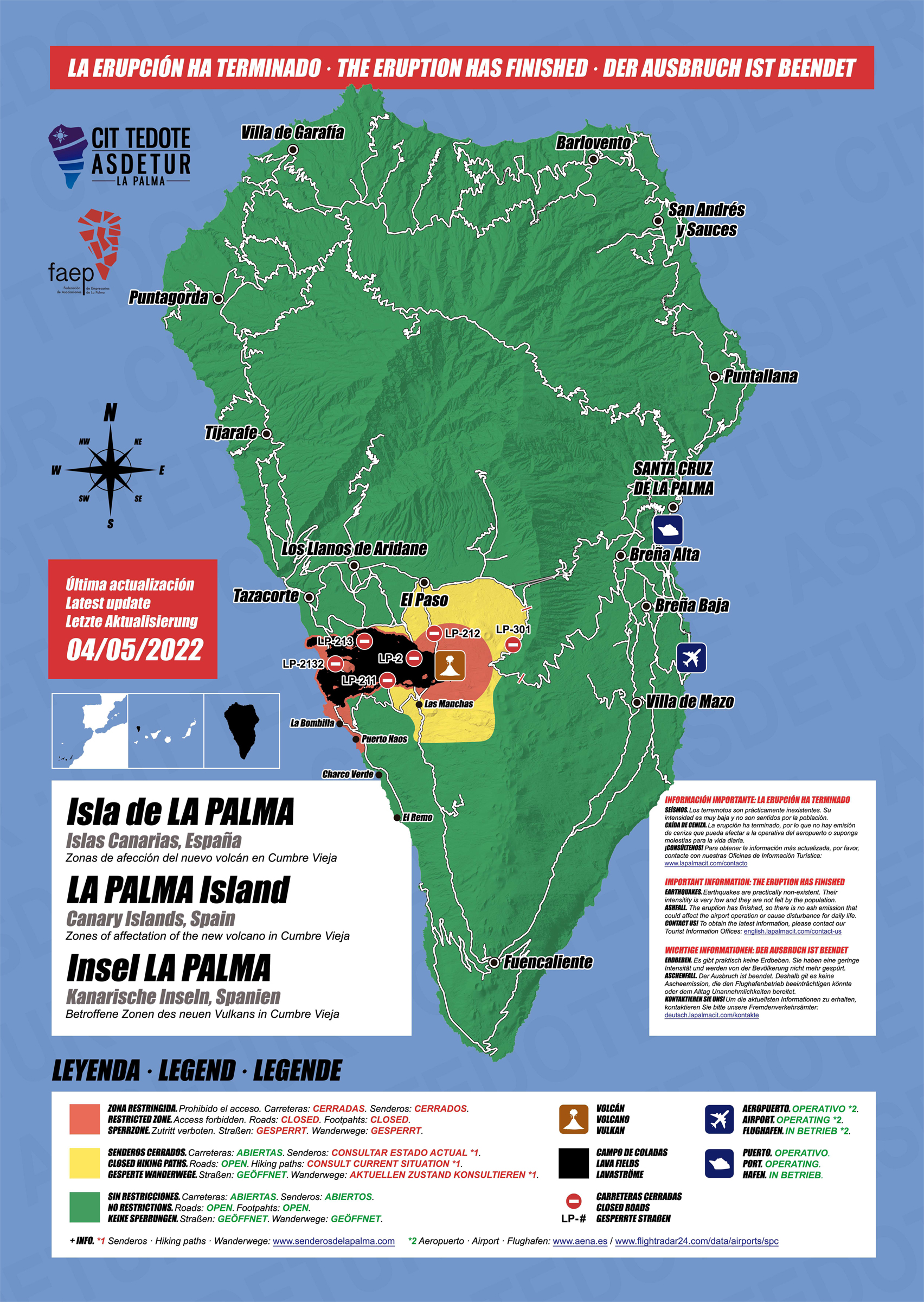
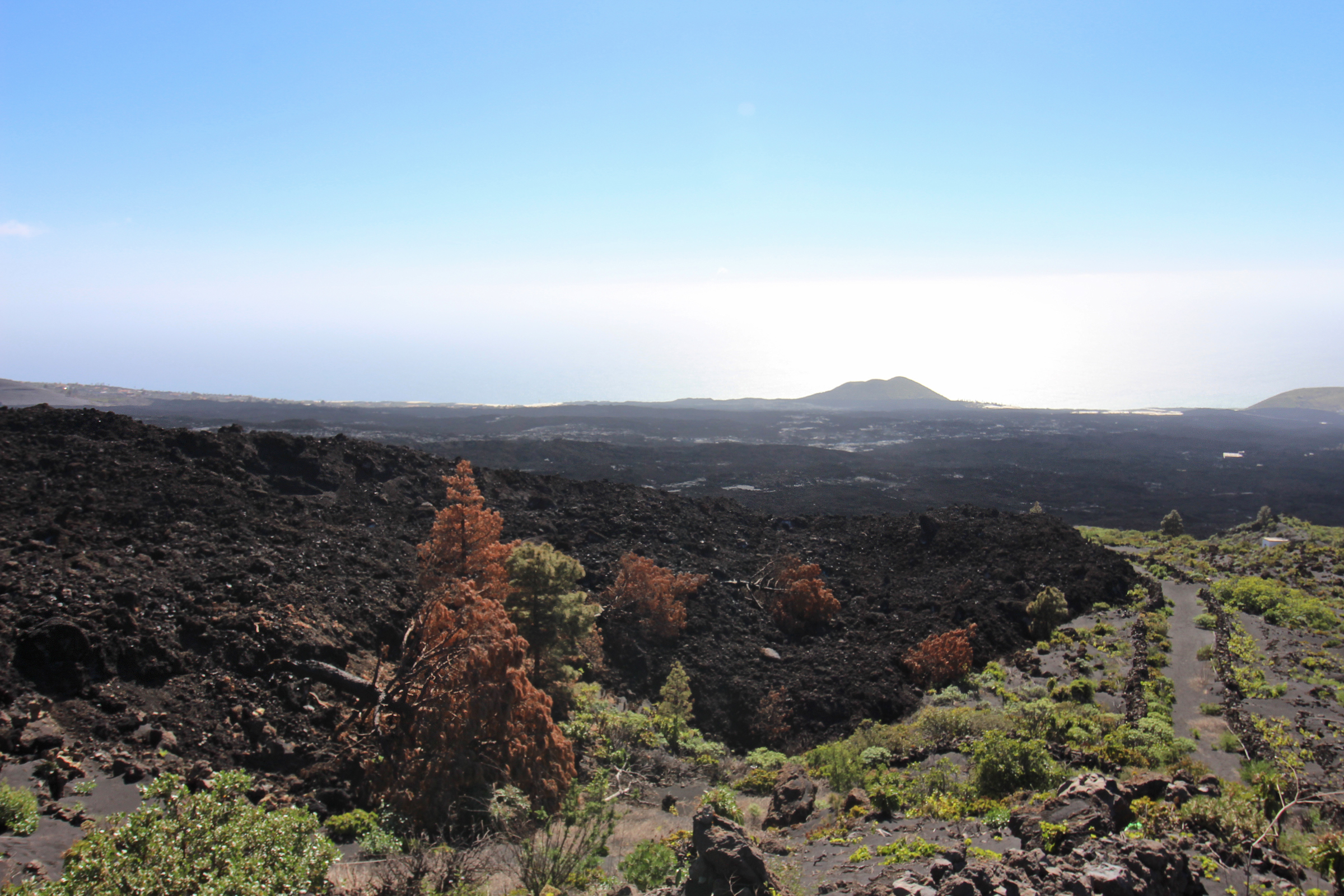
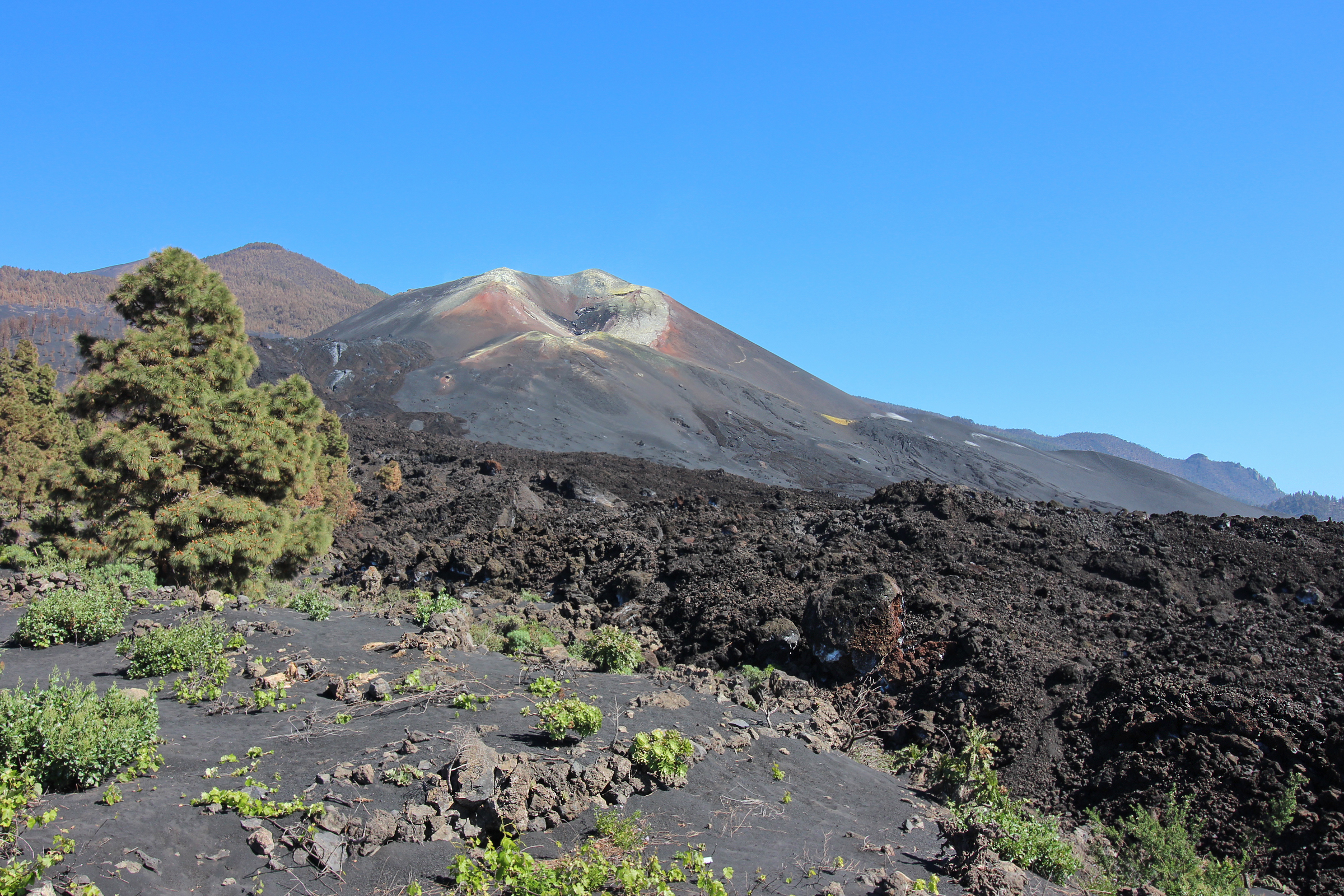
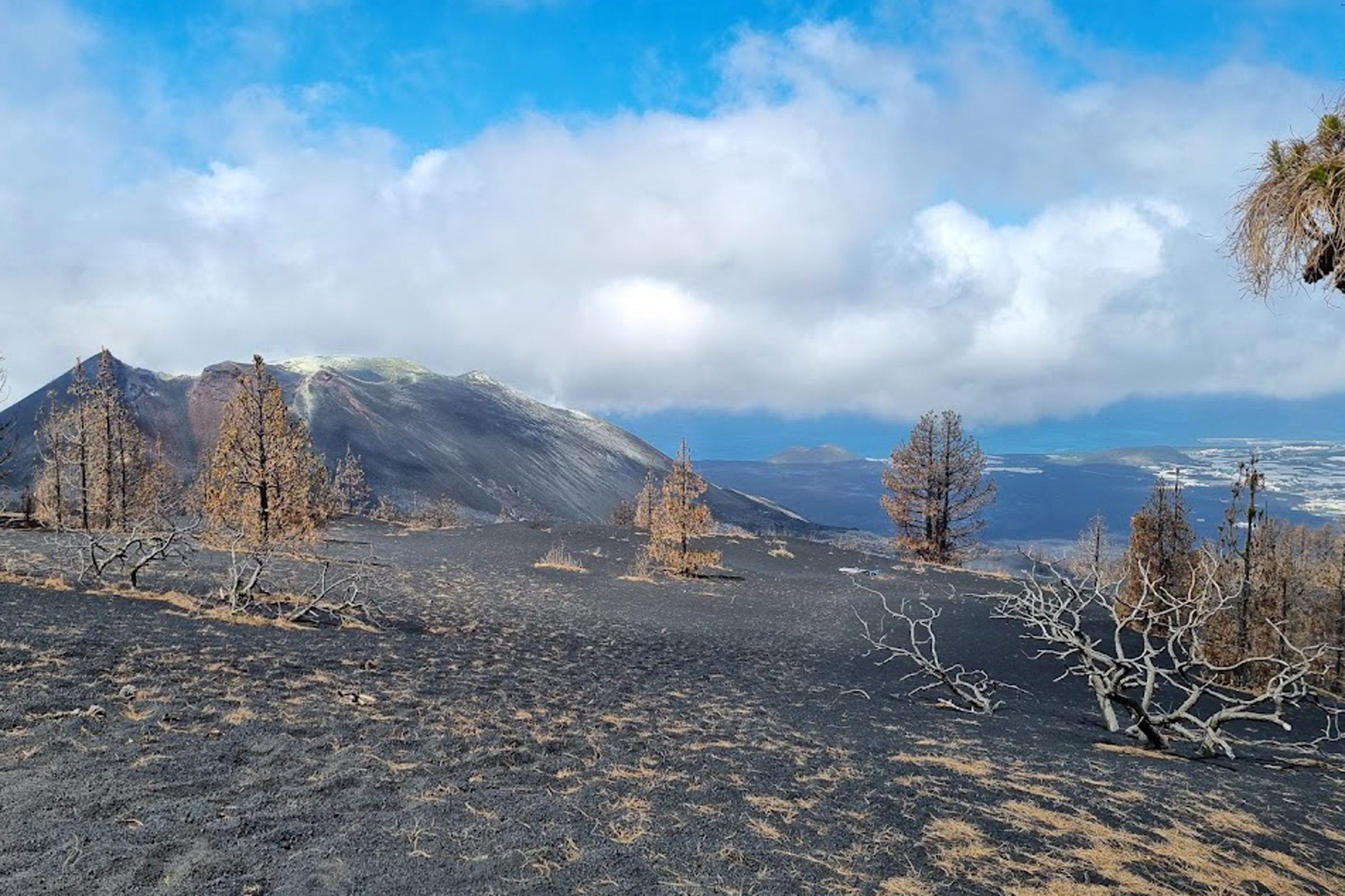
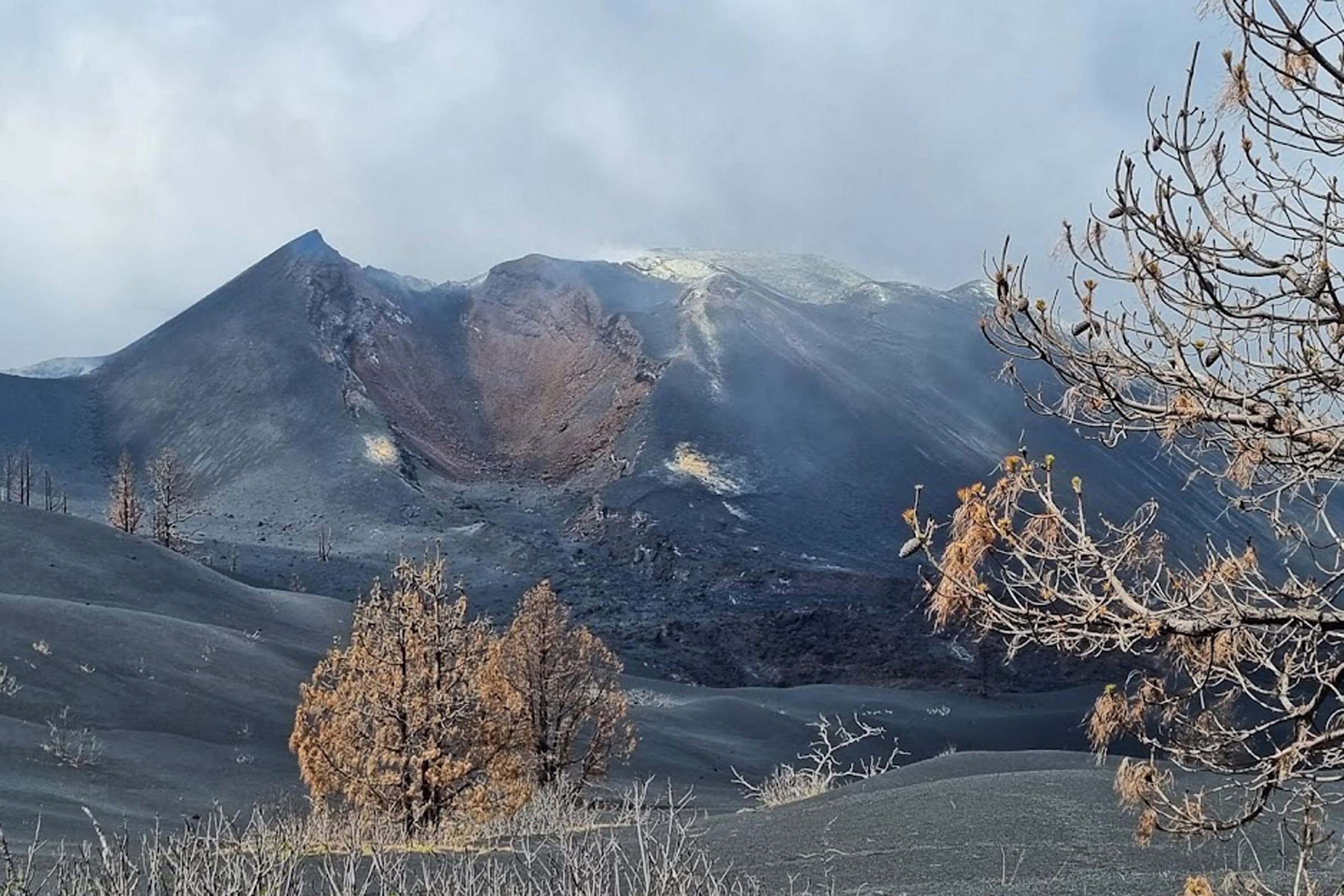
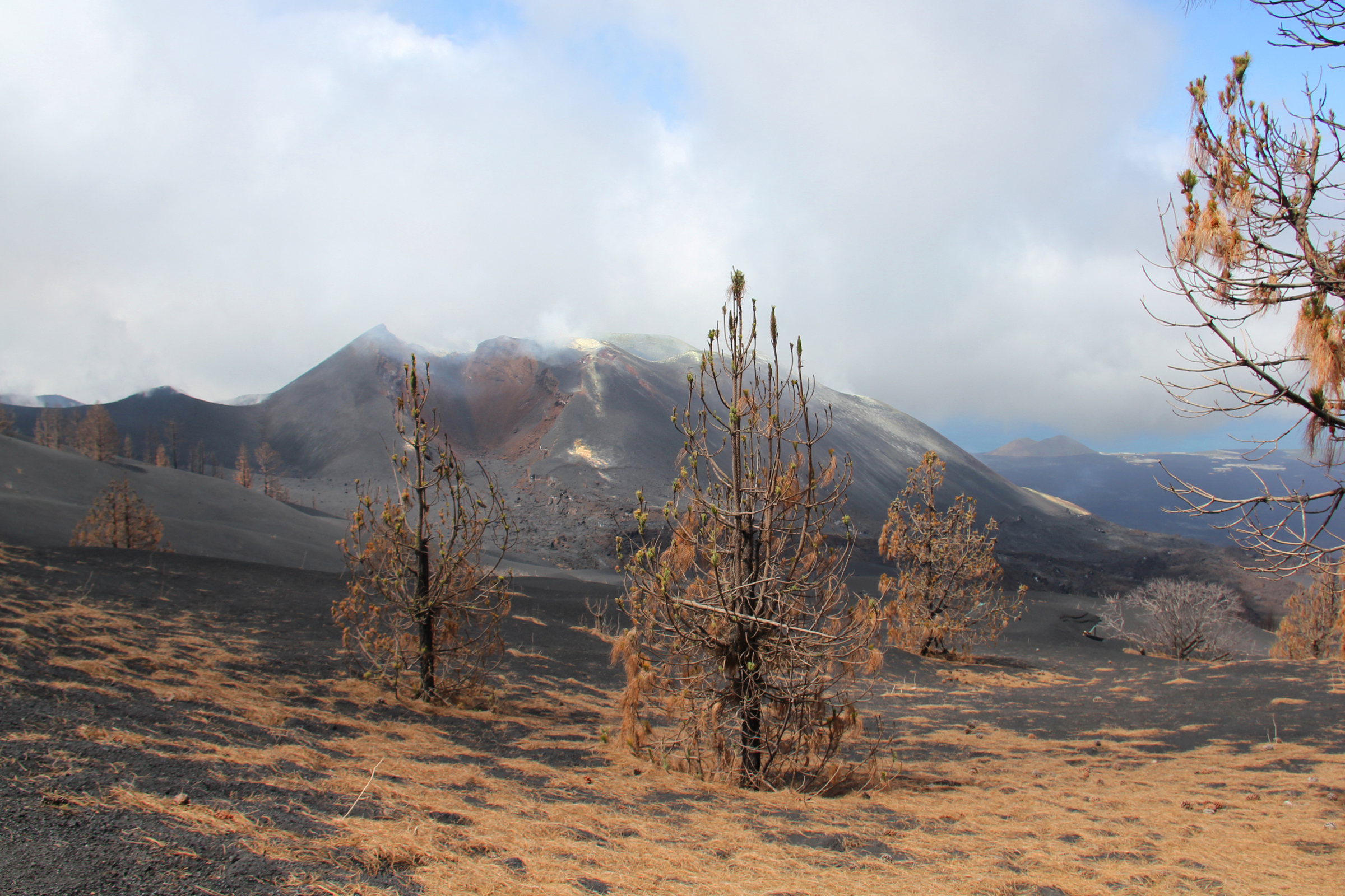
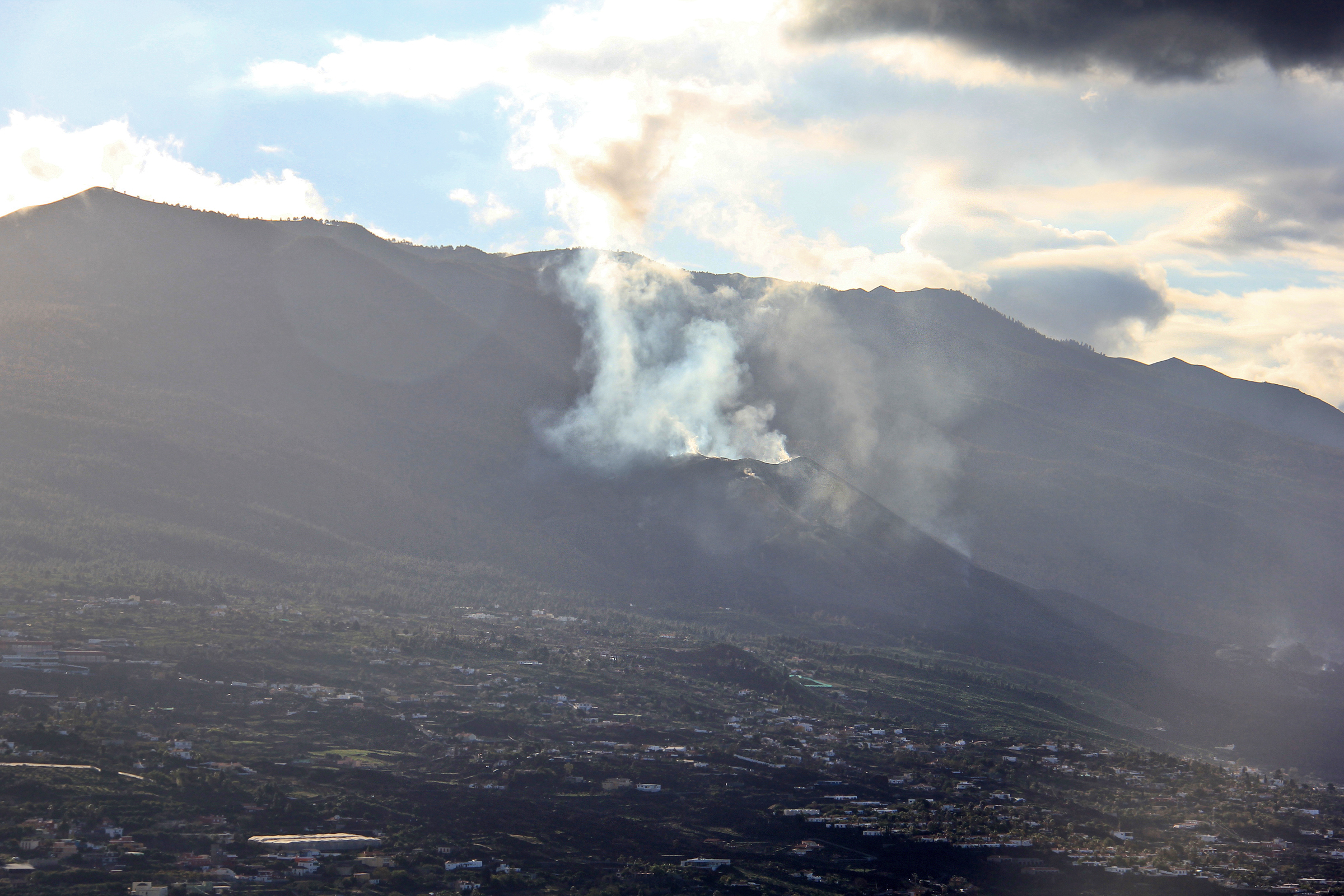
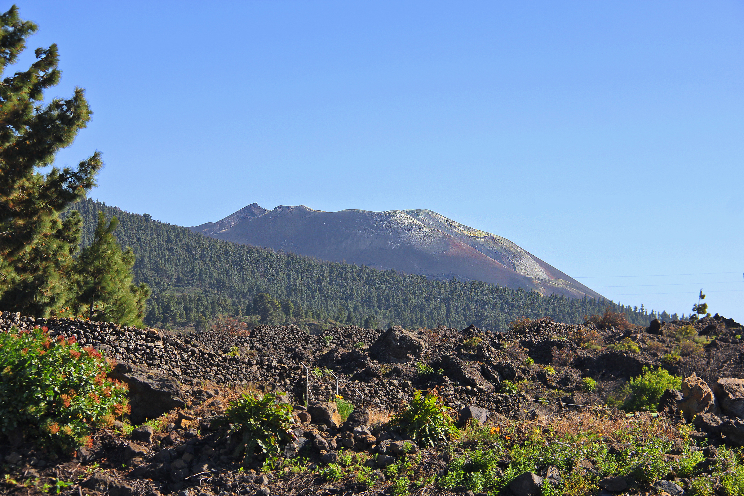
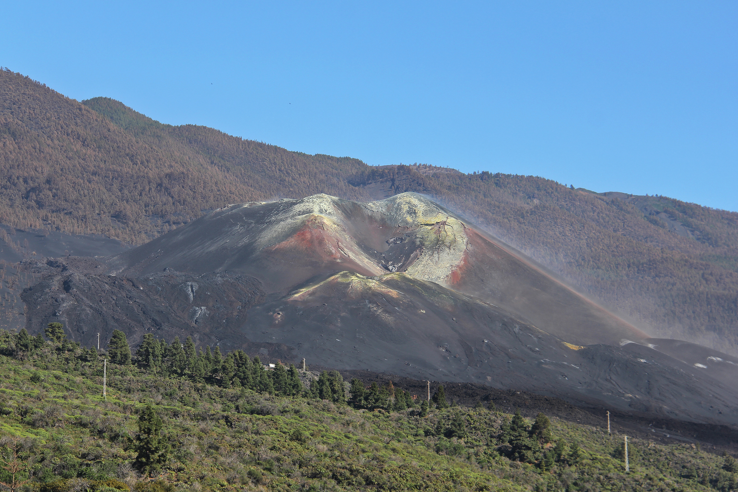
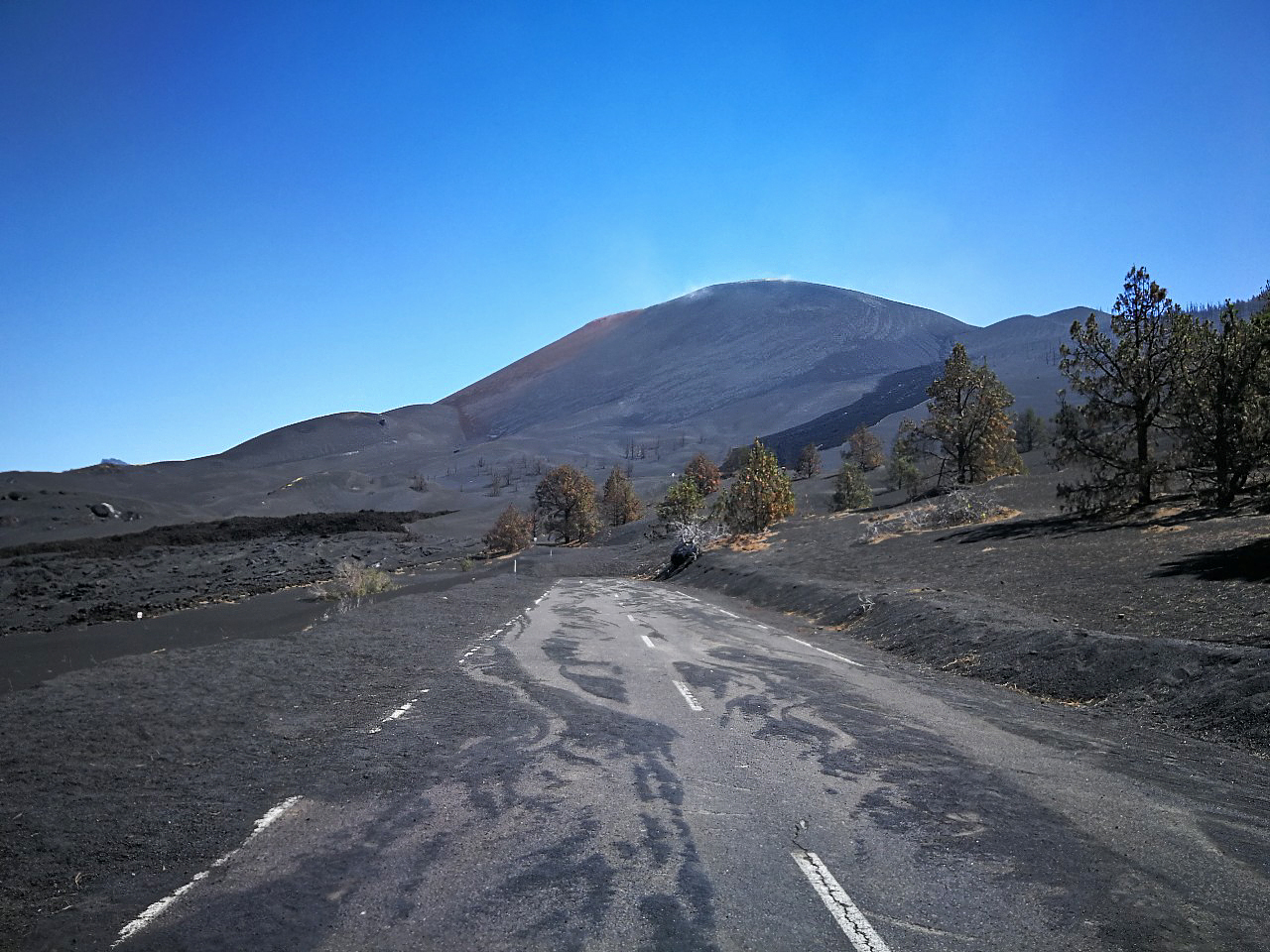
Seeing the Cumbre Vieja Volcano - Viewpoints and Tours
The volcano
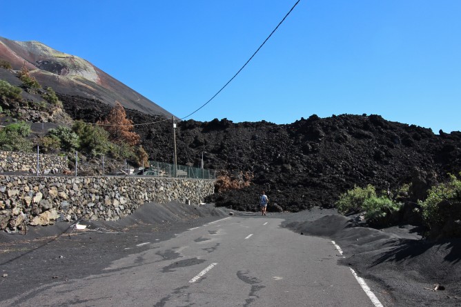
Driving through the lava flow...
The new road between La Laguna and Las Norias, which reunites the north with the south, is now open in both directions.
How to get to the new volcano on Cumbre Vieja
Guided tours and viewpoints
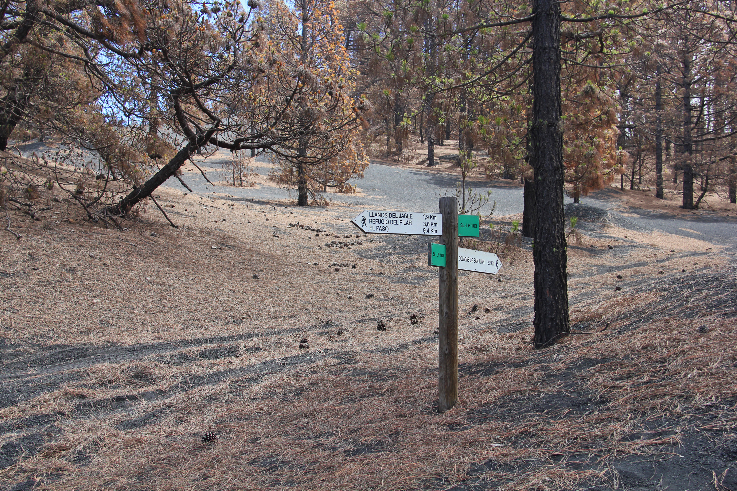
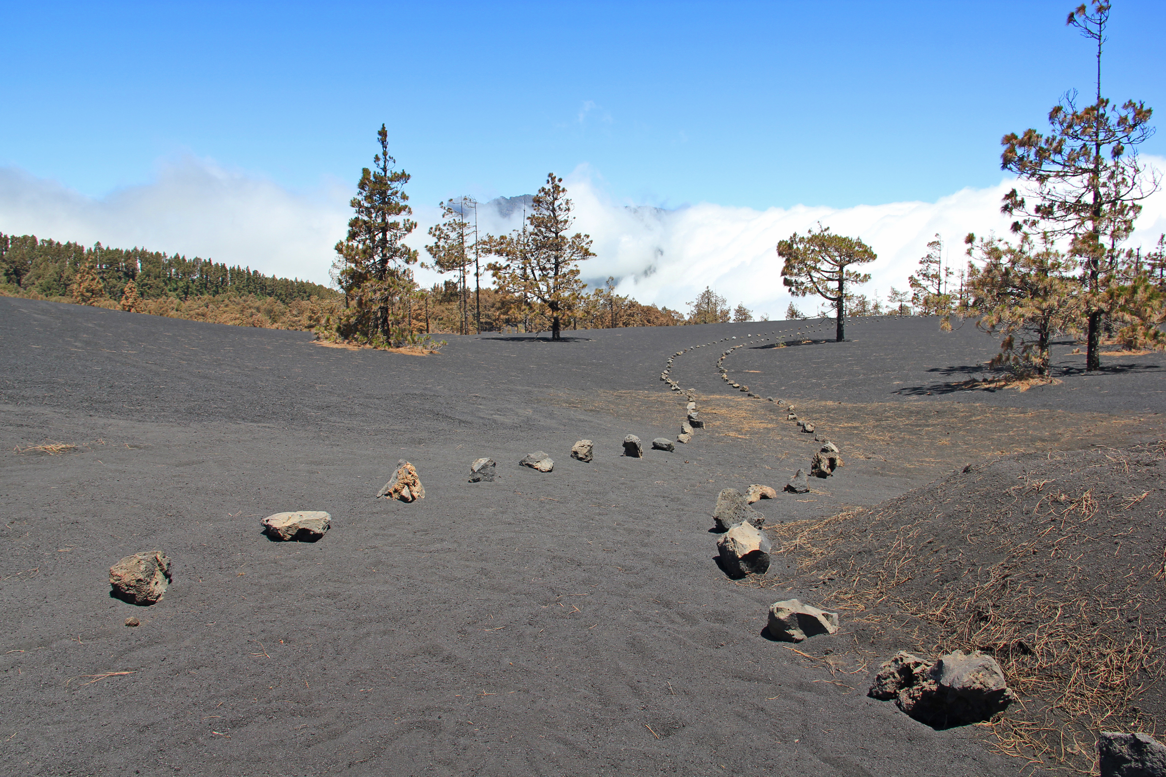
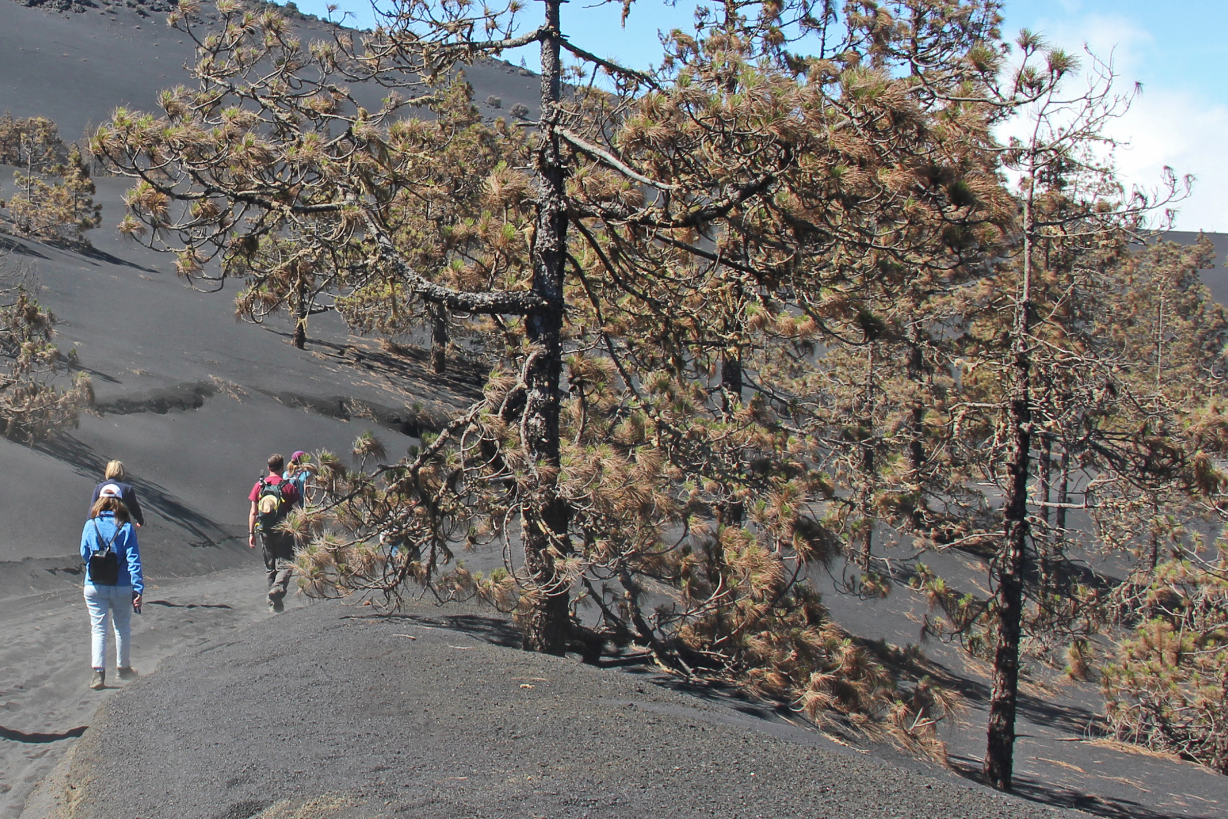
The recently opened 5-kilometre trail to the foot of the Cumbre Vieja volcano starts in Llano del Jable and takes you along the Cabeza de Vaca path.
You can get there on a guided tour, providers can be found further down this page. The volcano is inactive, but it still emits gases. Therefore, access to the route is by appointment only, as it is in a restricted area and is regulated and controlled by the Cabildo of La Palma.
The full route of the trail is 22 kilometres long (1,207 metre difference in altitude) and passes through the municipalities of Mazo, Fuencaliente and El Paso. The route ends at the lava flows in the Cumbre Vieja Natural Park.
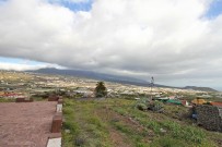
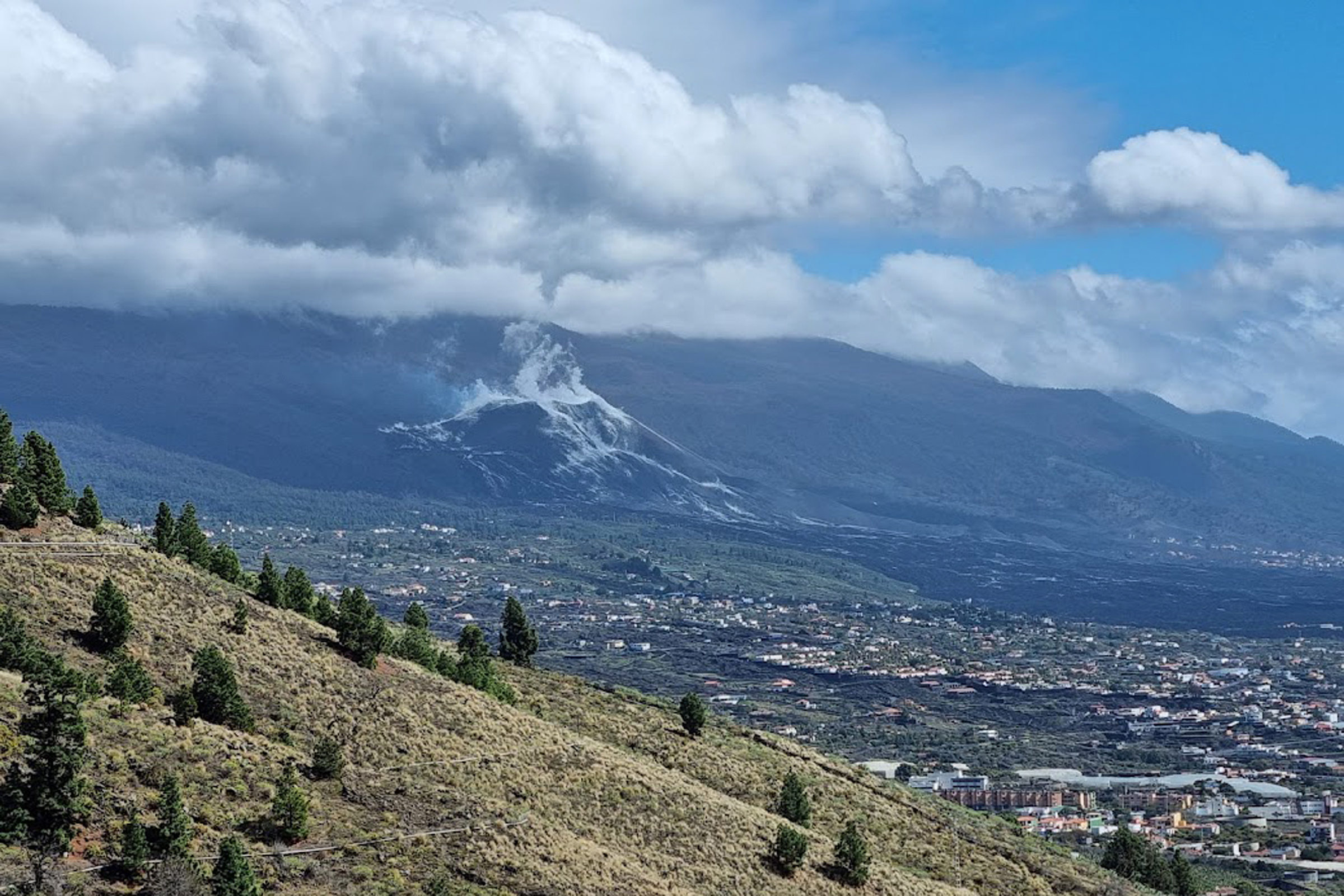
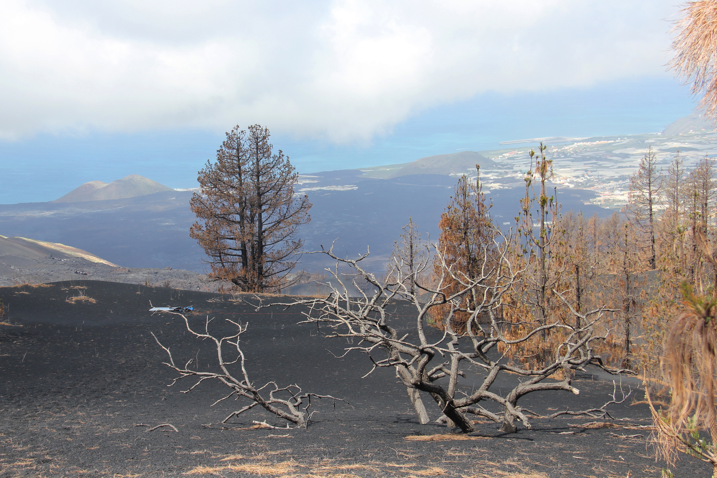
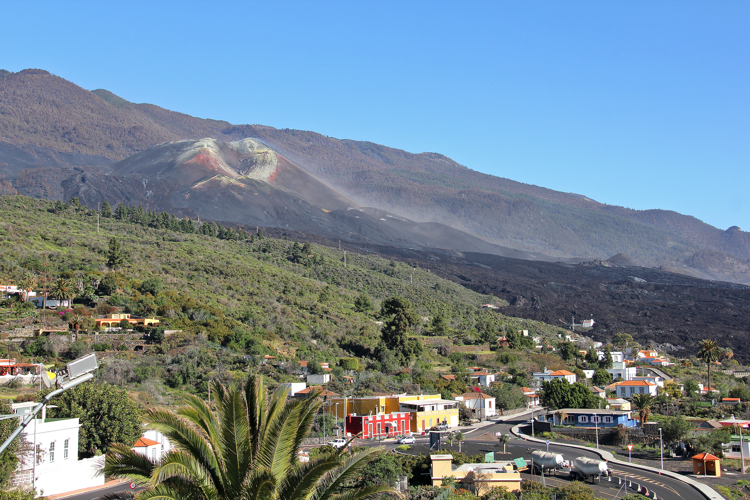
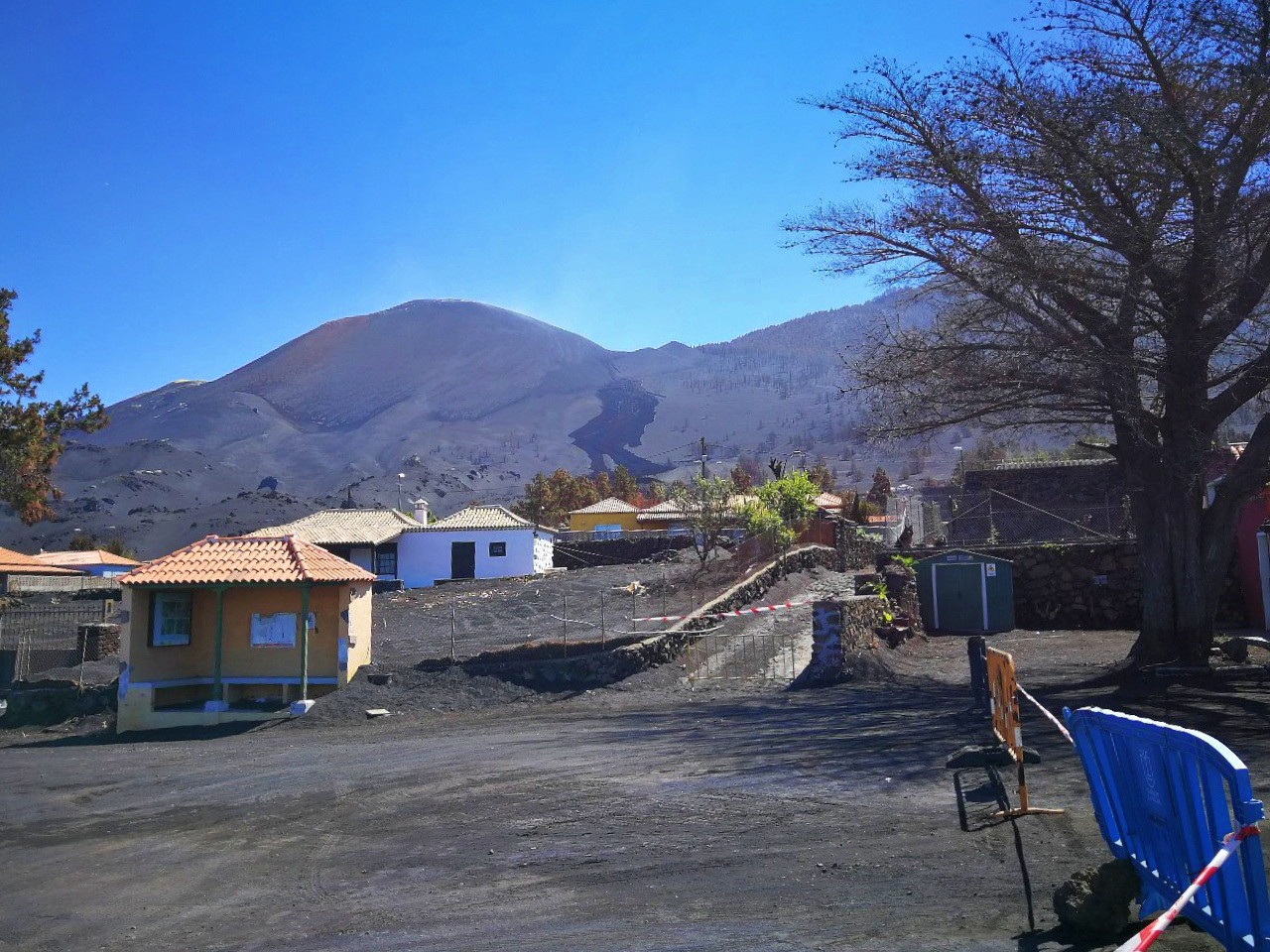
Mirador de Tajuya
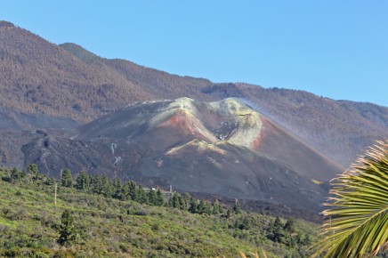
The viewpoint at Tajuya (El Paso) is one of the closest places to the volcano.
This was also the main location of the many international television crews that came to the island to report on the volcanic eruption on Cumbre Vieja on the Canary Island of La Palma. Here you can see the whole panorama - from the new "mountain" and the lava flow to the coast.
The viewpoint is located next to the church and community centre of Tajuya on a bend in the main road Carretera General Tajuya (El Paso municipality). Please watch out for pedestrians on the roadway - they are most likely on their way to the Cumbre Vieja volcano viewpoint just like you.
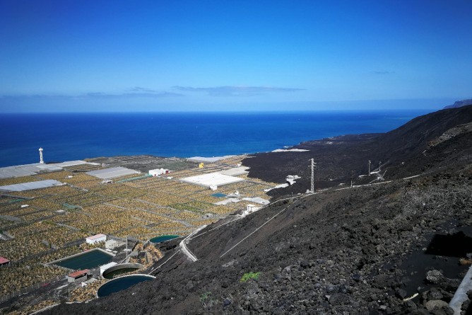
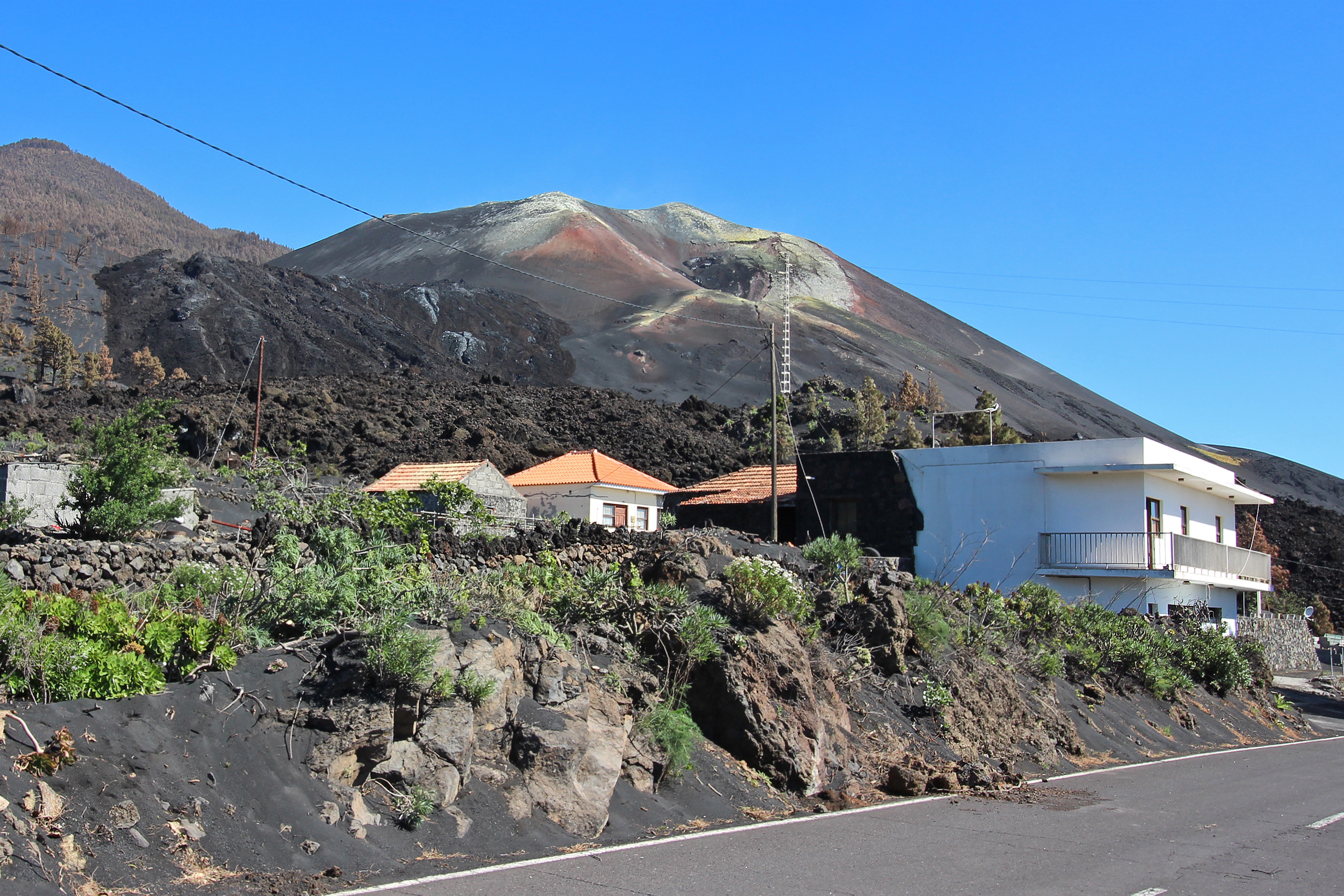
Carretera de San Nicolás - Tacande
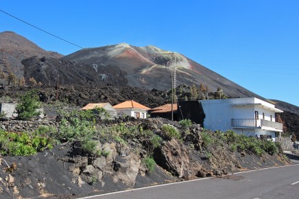
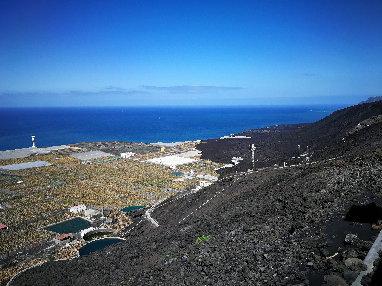
Here you can see very impressively how the lava of the volcano has rolled into the landscape and cut off the upper connecting road to San Nicolás.
The irrigation pipeline, which was so important for the dry south and carried the precious water from the Caldera de Taburiente, has also been blocked.
The volcano appears very close behind the houses. The Cabeza de la Vaca area is part of the immediate neighbourhood here.
Follow the Carretera San Nicolás in Tacande-El Paso. The road is open until Camino Espigón. There you can walk a little further and come to a small viewpoint.
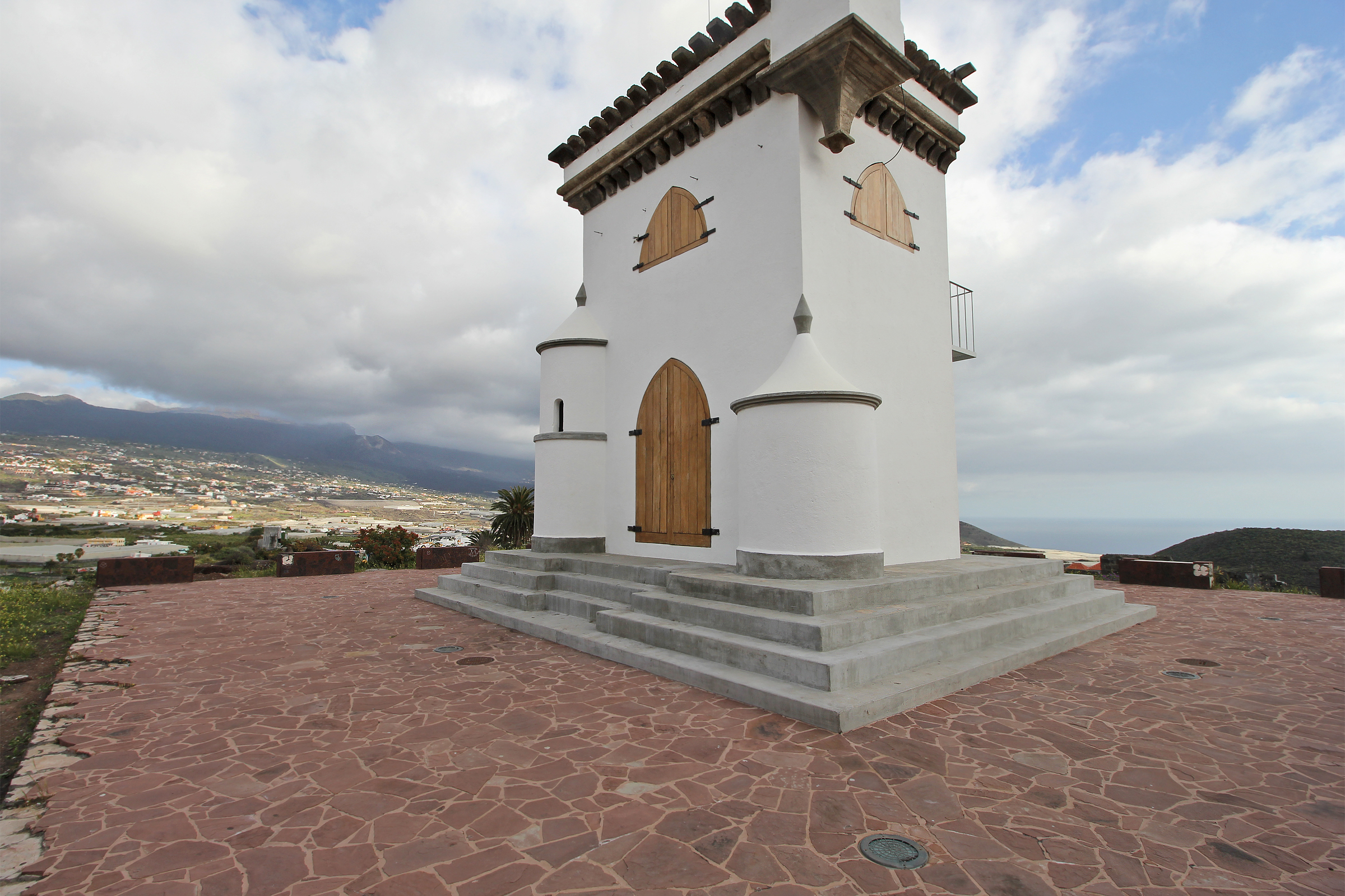
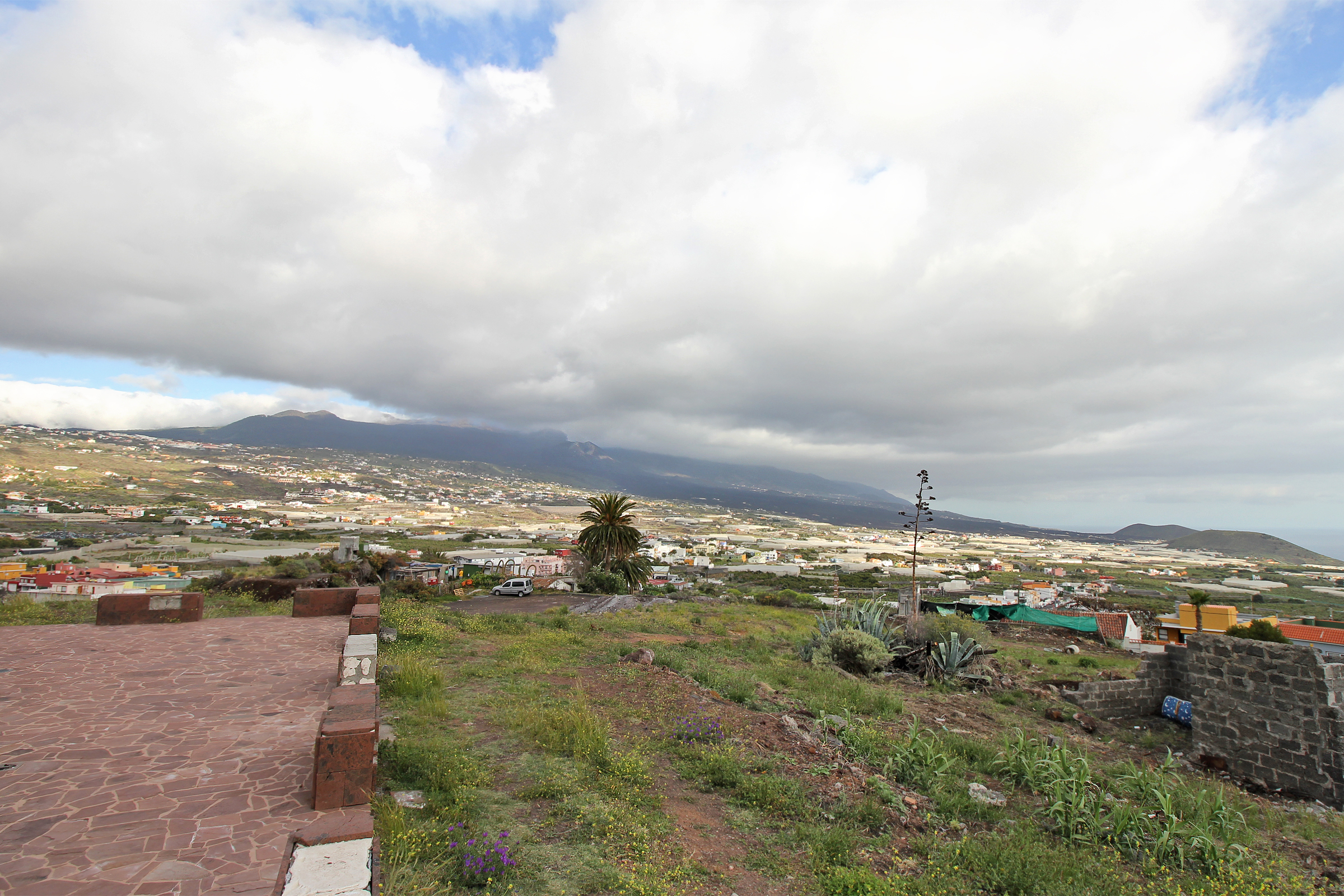
Castillo de La Virgen Montaña Tenisca - Los Llanos de Aridane
 The small castle Castillo de La Virgen on the mountain Montaña Tenisca offers an interesting view of the lava flows of different heights of the Cumbre Vieja volcano - in the middle of the town of Los Llanos.
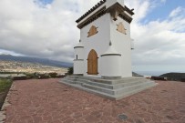 It is easily accessible and offers parking facilities. The small castle is located in the street Calle Francisca de Gazmira, 13A and can be reached either via the sloping district Montaña Tenisca, the steep one-way streets transport you to San Francisco moreover they are all named after noble Guanche men and women.
Another option is to take the main road LP-232 before reaching the town centre. You can either drive up or park at the bottom, where you will also find the terrace of the bar "La Tanqueta" (popular for its tapas, among other things). Caution: free-range chickens!
Nearby you can also admire the Antonio Gómez Felipe Park, designed by the artist Luis Morera.
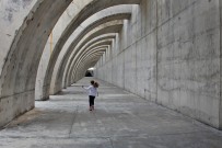
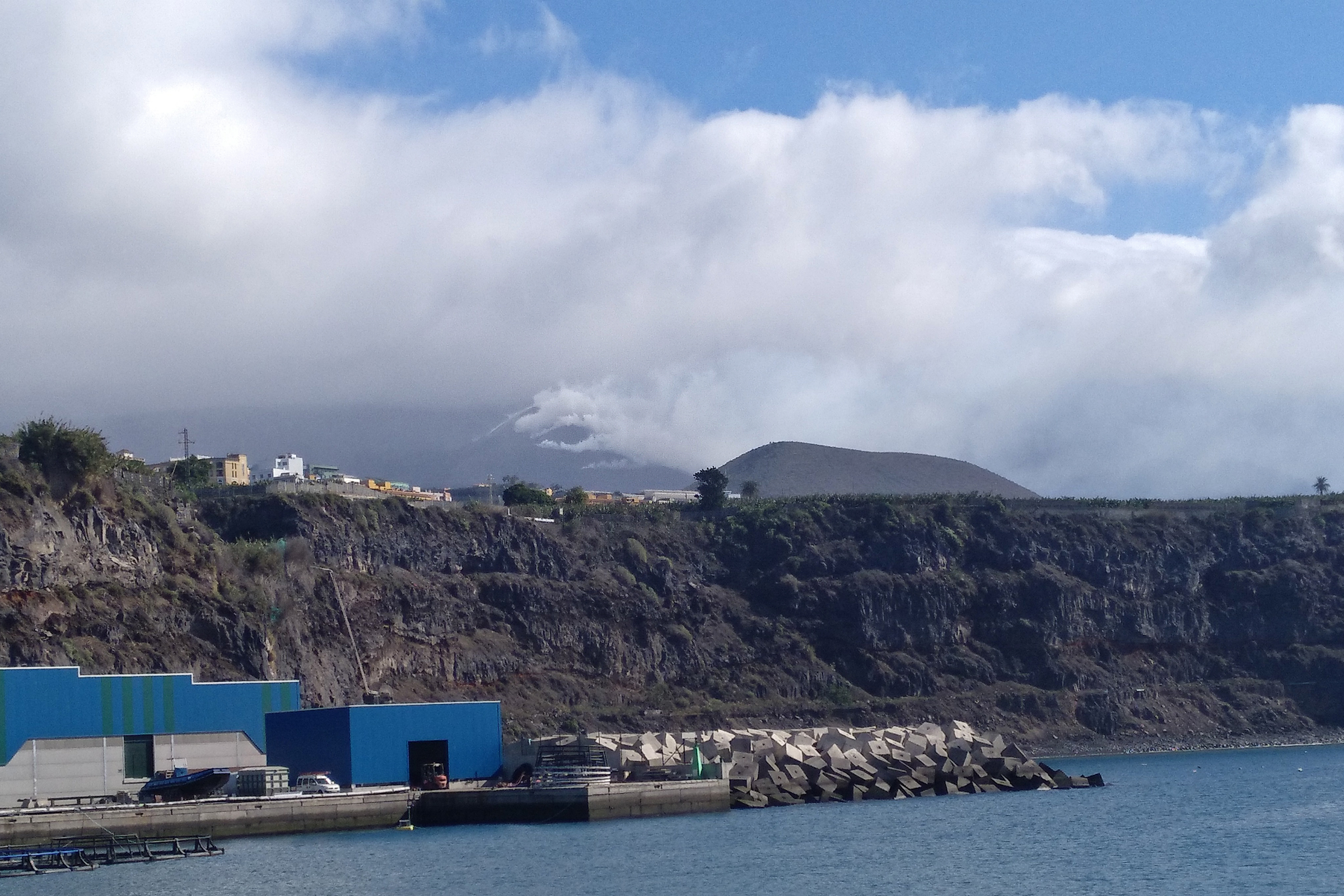
Puerto de Tazacorte - Sports Harbour
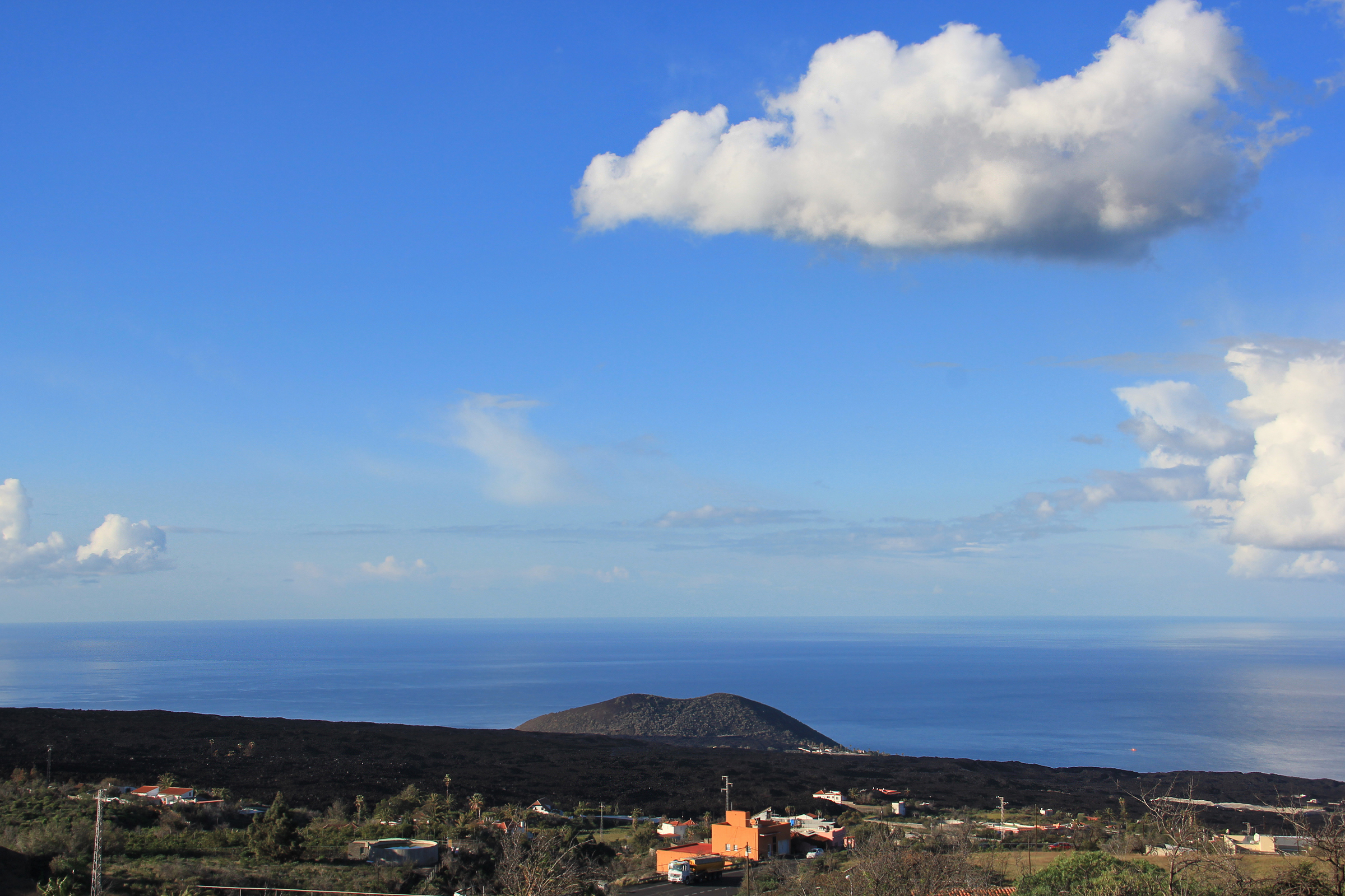
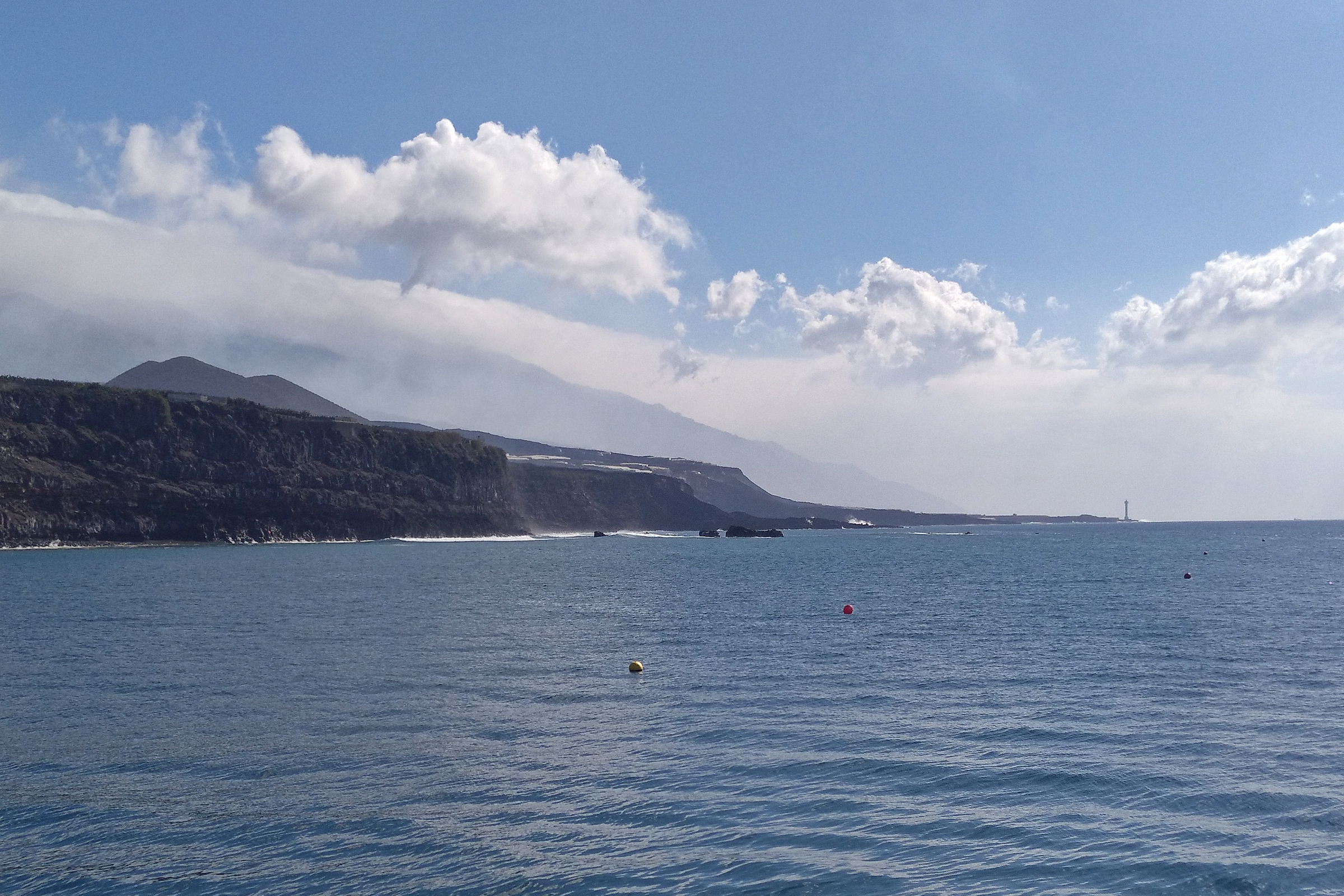
The marina in Puerto de Tazacorte is the best place to see the new lava deltas "Fajanas de Tazacorte".
In the harbour behind the characteristic arches, which are of course also an interesting photo motif, is a measuring station of the Volcanological Institute. While the wide Atlantic Ocean opens up to the right, you can see the impressive new land that the volcano has spewed out on Cumbre Vieja.
 Here in the harbour you can park easily and find three different fish restaurants – each of them is recommended.
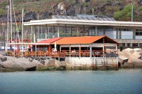 In "Varadero", the restaurant of the fishing guild, the fish is classically prepared, Restaurante "El Balcón" offers an uplifting view on the terrace and spoils its guests with Italian-prepared fish and organic wines, while the proximity to the sea can be experienced most beautifully in the Kiosko Adrinere next door. At weekends, churros de pescado are served here; the baked fish is especially popular with children. The harbour area is a good place to go out anyway; people like to come here to skate, for example.
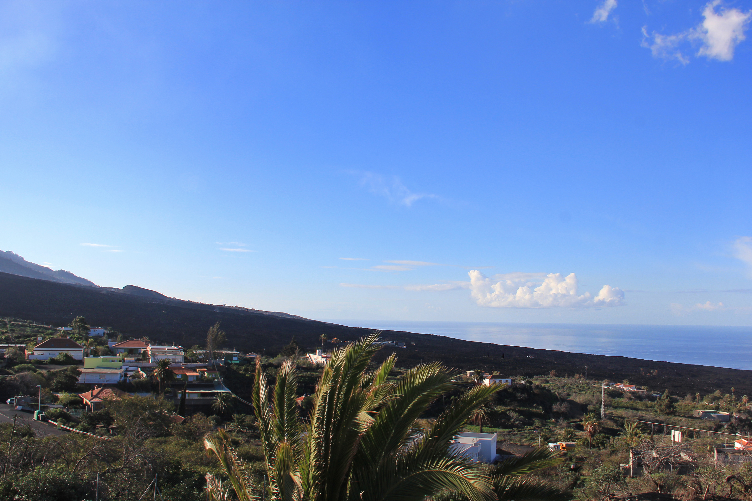
South side - Las Manchas - Puerto Naos
Coming from the southern tip of the island, i.e. Fuencaliente, there are possibilities to get to the cooling lava river in the village of San Nicolás and down towards Puerto Naos.
This picture shows from the Mirador Las Hoyas (view towards La Bombilla) how the lava mantle has flowed down the slope...
You can find more volcano views of the different locations in the gallery...
- Other options for volcano viewing:
- Caños de Fuego
- Above the Shell petrol station and almost directly below the roundabout ("stone henge") on the LP-3, on the right-hand side (coming from the east side or the Casacada restaurant) is the furniture store "Centro Comercial del Mueble" (Ctra. General, 15G) from whose car park the volcano can also be seen quite well.
- The viewpoint "El Time" in Tijarafe offers a good overview of the Aridane valley, but is quite far away from the volcano.
- From the "Virgen de Fátima" in Las Manchas you can see both the new volcano and the lava flows of the San Juan volcano (1949). However, you can only get there via the south of the island, i.e. via Fuencaliente and Fuencaliente can currently only be approached via the east side.
- Caños de Fuego
Fajanas and new beaches
Videos from La Palma Resiste.
North delta - Playa de El Perdido
South delta - Las Hoyas
Guided tours
Graja Tours

Tour in German, Spanish, English. Meeting point opposite the Caldera Visitor Centre at Restaurante Las Piedras. Adults 40 €, children 20 €, residents Canaries 30 € (child 15€), residents La Palma free tours on Saturday and Sunday.
From Llano de Jable we take the old forestry track on thick layers of ash as if on black snow through newly sprouting burnt pine forest to about 500m above the new volcano crater. From here, a completely new perspective opens up, even if we cannot see directly into the crater. Return via the same route.
Distance 5km, approx. 2 hours. More info...
isla bonita tours
La Palma Outdoor
Tour: Visit the new volcano from Las Manchas (southern part of the erupted volcano).
Duration: 5 hours / Languages: Spanish, German and English. Info here...
La Palma Palma Natural - Excursions in Spanish and Italian
Tour: Visit of the crater of the new volcano
Monday, Tuesday, Wednesday, Thursday and Sunday. Info here...
Road map / Hiking trails
Cumbre Vieja Volcano
Official website of the tourist association of La Palma: https://www.lapalmacit.com/volcan
Rating and Comments


Vielen Dank für die Infos und die sehr gute Betreuung unseres La Palma Aufenthaltes.
La Palma Travel ist sehr zu empfehlen, da immer eine deutschsprachige Beratung bei Problemen zur Verfügung steht. Vielen Dank Frau Roth