-

-
We are specialists for your holidays in La Palma. With personalized assistance on-site.
Ulrich & Evelyn Roth -
Our service numbers
Write e-mail+34 822 68 00 89
+49 7442 819 85 90
We're available from Monday to Friday from 10:00 a.m. to 6:00 p.m., and Saturdays from 10:00 a.m. to 1:00 p.m.
-
Accommodations
- with pool 90
- on the seaside 41
- with internet 201
-
Northwest >>
130
- Aguatavar 7
- Arecida 6
- El Castillo 1
- Garafía 4
- Las Tricias 7
- Puntagorda 42
- Tijarafe 22
- Tijarafe Costa 6
- Tijarafe El Jesús 12
- Tijarafe La Punta 21
- Tinizara 2
-
Aridane Valley >>
227
- Celta 7
- Charco Verde 3
- El Paso 23
- Hermosilla 1
- La Bombilla 2
- La Laguna 11
- Las Manchas 24
- Las Norias 11
- Los Llanos de Aridane 26
- Puerto de Naos 46
- San Nicolas 8
- Tacande 2
- Tajuya 9
- Tazacorte Costa 5
- Tazacorte Puerto 14
- Tazacorte Villa 23
- Todoque 12
-
South >>
31
- Fuencaliente 7
- Las Indias 4
- Lomo Oscuro 1
- Los Quemados 6
- Salemera 2
- Tigalate 2
- Villa de Mazo 9
- East >> 16
-
Northeast >>
5
- Barlovento 2
- Los Sauces 2
- Puntallana 1
Summer Hike at Refugio El Pilar – Cumbre Vieja Natural Park
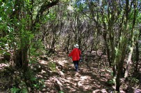
Shaded Sections make the Hike specially enjoyable in Summer!
A 3 ½ hours hike, mainly in the shade, on the way back it goes about 2 km uphill at a stretch.
Refugio El Pilar (El Paso) – PR-LP 18 – Área Recreativa Pared Vieja (Breña Alta) - Mirador Llano de Las Ventas – PR-LP 17 "Camino de la Faya" – Refugio El Pilar (El Paso)
Hikable all year-round/total distance: 5.4 km
-
We start our hike at the Refugio El Pilar in El Paso on the West Side of the Island La Palma
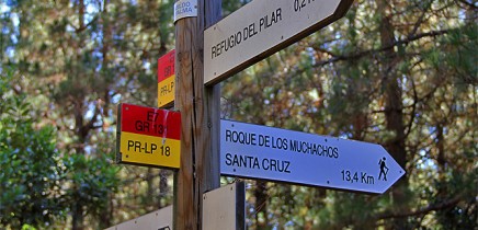
First, we follow the road 200 meters uphill until we reach an information board on the left.
The district of Breña Alta starts right here and we are now already on the island's east side.
We take a left turn onto the hiking trail PR-LP 18, that is signposted as Roque de Los Muchachos/Santa Cruz.
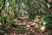
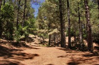
The crunch of pine needles beneath our feet, we continue downhill through pine trees, tree heathers and sweet gales.
Soon, we reach the trail marker pointing to the "Pared Vieja" and follow the hiking trail PR-LP 18.
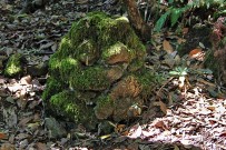
The smell of the pine sap is extremely aromatic, lichens and moss cover the trunks. Photo encounters await you at every turn, like tree figures and piles of stones, that seem to be naturally-formed.
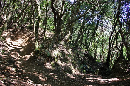
Leaving behind a short, sunny section, we continue walking in the pleasant shade.
Along the way, there are steeper ascents and you have to be careful not to slip.
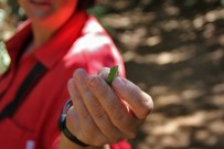
Everywhere the ripe fruits of the Canary Island laurel tree are lying around - a treat for the shy Bolle's pigeon (dove species).
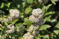
The less pine trees grow there, the more the diversity of the undergrowth becomes evident. Ferns, mayflowers, violet leaves, cranesbill, amber, oregano...
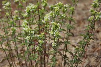
In the sunniest areas, shrubs of the mint species "poleo de pinar" grow up to 2 meters.
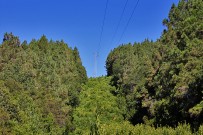
A power line stretches straightaway down the mountain.
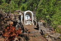
The below proliferation is trimmed and kept short for protection against fire.
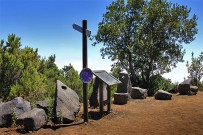
We reach a wayside cross which is marked as point 6 of the hiking trail "sendero autoguiado“.
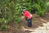 This trail takes us in numbered consecutive ascending order to the recreation area Pared Vieja.
Right below the cross there is a semi-circular area with two tall pine trees.
It served as a rest area for people, who once crossed the central mountain range from east to west or the other way round.
At point 7 there is the storage tank that supplies the recreation park with spring water.
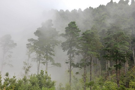
Section No. 8 clearly shows us the borderline between the Monterey pine, introduced by humans and the natural grown tree heathers, fire trees and laurel forest.
As soon as we reach the grounds of Pared Vieja, we understand the origin of its name "Atrevasando el mar de nieblas".
It means "walking accross the sea of fog", and even in mid summer clouds are gathering, driven by trade winds providing a fresh breeze.
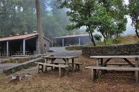
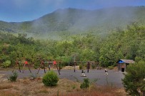
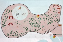
The inviting and beautiful arranged local recreation area at 1215 meters is fully provided.
Among the facilities is a large children's playground, surrounded by green fields - perfect for a picnic.
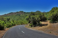
In order not to take the same trail back, we follow the paved, but rarely used LP-301.
The rich flora along the roadside as well as the viewpoint Mirador de las Ventas compensate for the long ascending track.
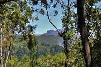
Shortly after, we sneak a peek through the trees of the mountain tops of the Caldera de Taburiente.
We follow the road to the area Pajonales.
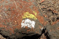
From there, the nicely, yellow-white marked trail "Camino de la Faya“ PR-LP 17, that leads past the Acropark with its zip line, soon takes us back to the Refugio El Pilar.
This hike can be done year-round, however, during winter you should bring a warm sweater and rainwear.
Temperatures at both rest areas are perceptible cooler during the rest of the year.


