-

-
We are specialists for your holidays in La Palma. With personalized assistance on-site.
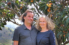
Ulrich & Evelyn Roth -
Our service numbers
Write e-mail+34 822 68 00 89
+49 7442 819 85 90
We're available from Monday to Friday from 10:00 a.m. to 6:00 p.m., and Saturdays from 10:00 a.m. to 1:00 p.m.
-
Accommodations
- with pool 83
- on the seaside 38
- with internet 194
-
Northwest >>
131
- Aguatavar 7
- Arecida 6
- El Castillo 1
- Garafía 4
- Las Tricias 7
- Puntagorda 43
- Tijarafe 22
- Tijarafe Costa 6
- Tijarafe El Jesús 12
- Tijarafe La Punta 21
- Tinizara 2
-
Aridane Valley >>
229
- Celta 8
- Charco Verde 3
- El Paso 23
- El Remo 1
- Hermosilla 1
- La Bombilla 2
- La Laguna 11
- Las Manchas 24
- Las Norias 11
- Los Llanos de Aridane 26
- Puerto de Naos 46
- San Nicolas 8
- Tacande 2
- Tajuya 9
- Tazacorte Costa 5
- Tazacorte Puerto 14
- Tazacorte Villa 23
- Todoque 12
-
South >>
35
- Fuencaliente 7
- Las Indias 4
- Lomo Oscuro 1
- Los Quemados 6
- Salemera 2
- Tigalate 2
- Villa de Mazo 13
- East >> 19
-
Northeast >>
5
- Barlovento 2
- Los Sauces 2
- Puntallana 1
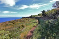
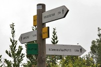
Marked Hiking Trails
Ancient tracks, traditional trail types and current marks
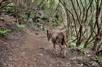
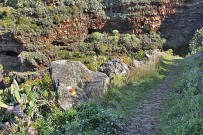 Ancient tracks provided the basis for the marked trail network on La Palma. They had already been used by the Benahoaritas, the native inhabitants and later also by new settlers.
Traditional types of trails
As it is written in the Topoguía of the Cabildo, there are four traditional types of trails which, despite of difficult terrain, allow to move on more effectively and quicker:
 Royal Trails (camino real) at average altitudes connect the most important places.
Transverse Trails (traviesa) run across a terrain in a more or less horizontal way from 1000 to 1300 meters altitude.
Radial Trails (camino radial) go up a mountain ridge from the coast to the highest mountain range.
Crest Paths (camino de cumbre) pass uphill and downhill the summits.
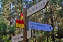
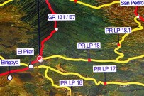
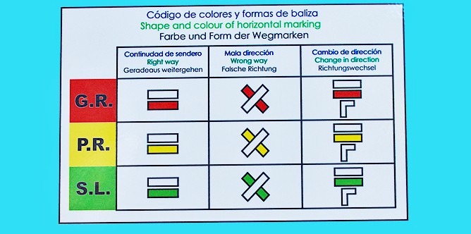
Today marked hiking trails with a length of almost 1000km are divided in three groups:
 Large Routes (gran recorrido) = GR
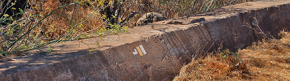
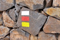
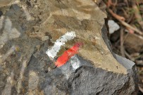
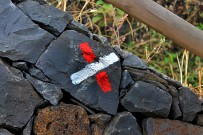
Trails with a length of more than 50km, divided into different stages. Marks are in red and white.
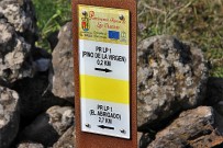
 Small Routes (pequeño recorrido) = PR
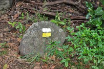
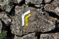
Trails with a length of less than 50km, that can be hiked on one day. Marks are in yellow and white.
 Local Trails (sendero local) = SL
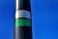
Trails with a length of less than 10 km, that can be walked in short hikes or in order to connect larger routes with each other. Letters show the initials of the district, in which they are located. Marks are in green and white.
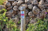
Official hiking maps explain colours and mark types very well.
Find herewith a summary of important hiking information for La Palma:
- Never hike alone. Not because there are robbers or wild animals, however, a sprained ankle can already cause a severe problem.
- Make sure to pack clothes in your backpack that protect you from wind, sun and rain. Don't forget head covering, sun milk and sun glasses.
- A snack and sufficient water are important as well, and so are cell-phone and a good hiking map.
- For a safer step better choose ankle-high hiking shoes.
- Listen to the weather forecast. In case of any danger of forest fire, heavy rainfalls or storms better enjoy the beach, visit a museum or enjoy delicious food.
